")
")


Departure/arrival: car park of Avène.
This itinerary, starting from the village of Avène, will take you up to the summit of Peyreguille and give you an exceptional view, between forest massifs and winding valleys around the famous Avène baths. A very varied forest itinerary, alternating tracks and mono-tracks, technical and rolling terrain, ideal for working on changes of pace over a short ride.
RECOMMENDATIONS
BEFORE YOU LEAVE:
> Check the weather forecast.
> Find out about the state of the route.
> Inform someone close to you about your itinerary and the planned times.
> Take water and food.
ON THE ROUTES, PLEASE:
> Stay on the marked paths for your safety and to preserve the vegetation. Do not cut the laces.
> Respect the natural environment and the properties crossed; close the barriers.
> Respect the highway code, which applies to all sections of the route that use public roads.
> Don't litter and keep your rubbish with you.
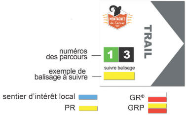
MARKINGS:
The courses are equipped with specific trail markers. Follow the course number indicated on the marker. Between two trail markers, follow the existing hiking markers: